A better way
to walk to
the shops.
Sienna Walkway imagines a continuous pedestrian connection beside the service road — linking the community centre route with the shops, through the trees and away from the narrow road edge.
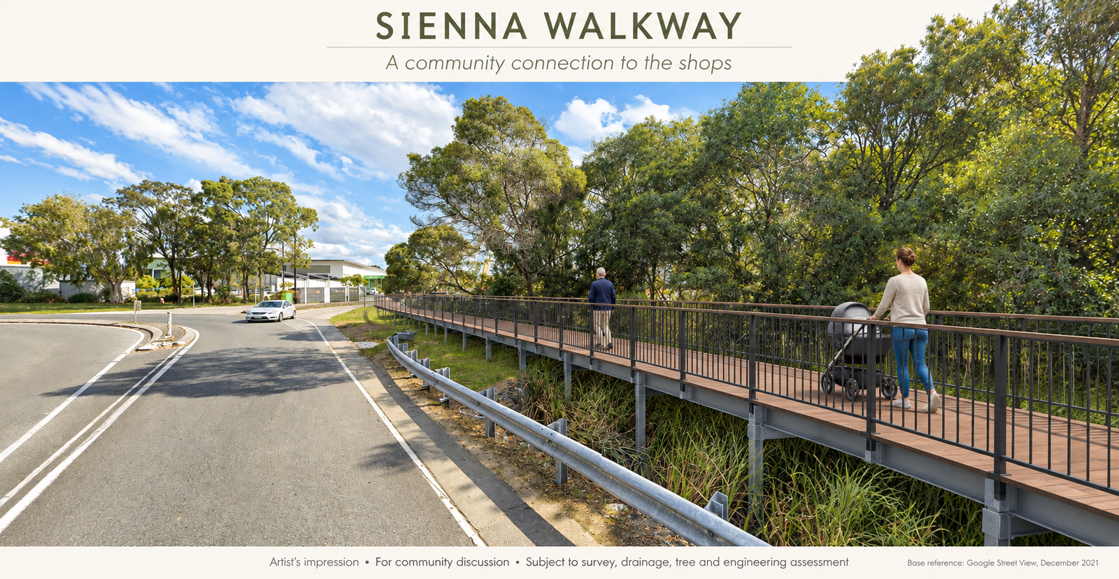
An everyday walk.
A shared concern.
Families, older residents and people carrying their shopping need a usable route between home and the shops.
A local resident reports a narrow, uneven walking verge along this service road, with dumped concrete, litter and shopping trolleys in the drainage area. These reported conditions can make an ordinary walk difficult, particularly with a pram or mobility aid.
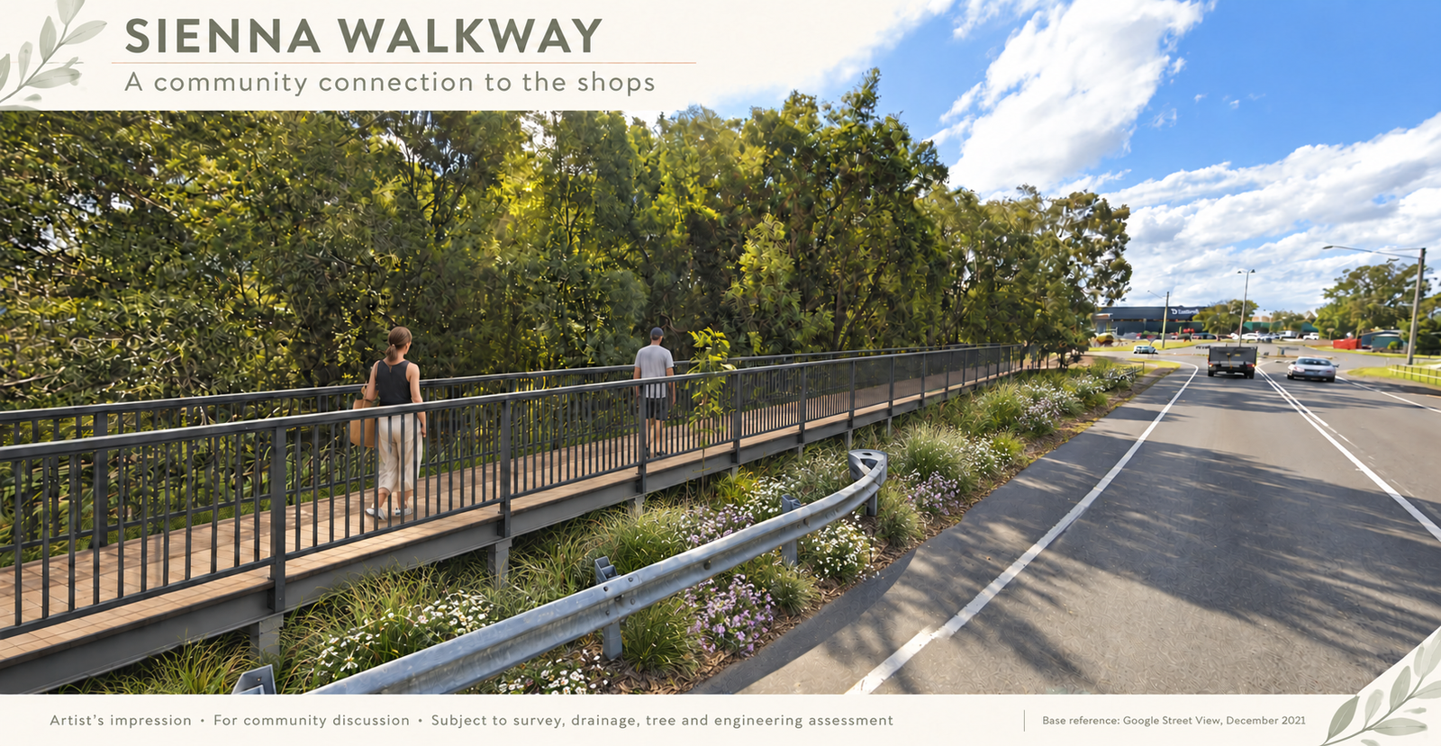
The proposal is to ask council to investigate a continuous accessible connection and consider a landscaped boardwalk, with bridge sections where needed over drainage.
The current-condition concerns are resident observations. The images on this website illustrate a possible future design; they do not document the present condition.
A path that belongs here.
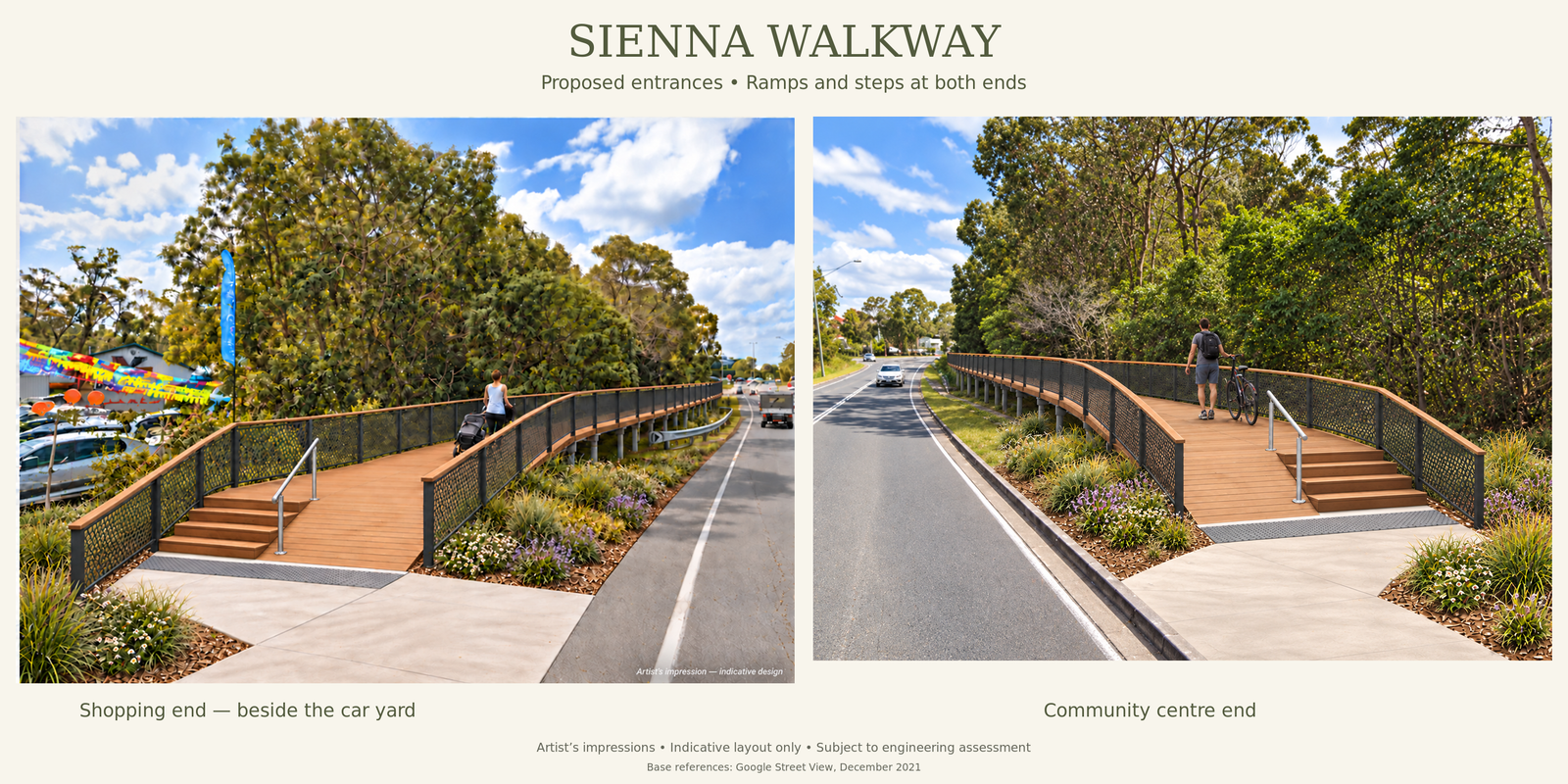
Timber-look decking, a leafy setting and simple entrances with ramps and steps. These concepts give the community a starting point for discussion with council.
What we’re asking
council to do.
The aim is a practical, continuous connection that works for the people who use this route every day.
Inspect the route
Assess the reported pedestrian hazards, obstructions and drainage conditions and consider any immediate measures.
Investigate the options
Confirm responsibility for the corridor and assess an accessible walkway, including boardwalk or bridge sections where appropriate.
Provide a pathway forward
Advise the community of feasibility, likely next steps and opportunities for design and funding consideration.
Help give the idea
a local voice.
See how to support the formal petition using council’s approved form.
This website does not collect signatures or personal information.